


Planimeter for map measure app for iPhone and iPad
Developer: 忠 张
First release : 10 May 2015
App size: 36.8 Mb
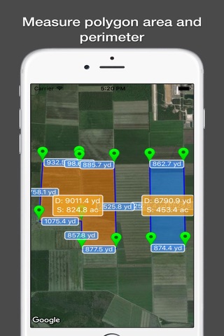
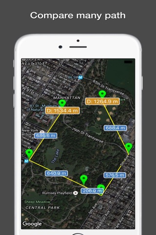
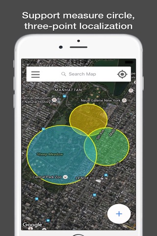
Planimeter is a tool to measure distance and area on map.
It can measure anything visible on the satellite map, like lawns, fences, farm, road, roofs and so on.
~~~~~~~~~~~~~~~~~~~~~~~~~~~~~~~~~~~~
● Thanks to more than 3250,000 people who have chosen "Planimeter Pro"
● "GREAT - Wonderful app. Very useful and easy to use. Most of the time I use it to measure distance sailed on San Diego bay." by Perfent
● "Great app for an accurate measurement - This app saves a lot of driving around! Good in the hi res areas" by DaveHebner
~~~~~~~~~~~~~~~~~~~~~~~~~~~~~~~~~~~~
Features:
● Support measure distance and area.
● Support measure as path, polygon, star or circle.
● Support measure multiple area at same time.
● Visual records list, save and share.
● Support Apple map and Google map.
● Use cross hair to location, easy and accurate.
● Locate by search or GPS.
● Support length unit like foot, nautical mile, mile,inch, yard, meter,kilometer.
● Support area unit like square meter, are, declare, hectare, square kilometer,acre and so on.
● Support custom unit, add any unit your needed.
● Fill color, board color and text is configurable.
● Support live record by GPS.
"Continued use of GPS running in the background can dramatically decrease battery life."